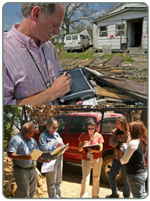
Information about the type and location of damage should be recorded. This includes mapping the damage in addition to providing a description. It should also include videos and/or photographs, when possible. It is important to keep accurate and thorough documentation because inaccurate or incomplete damage assessment information can cause inappropriate distribution of resources due to inaccurate setting of priorities. There could be increased negative environmental impacts. It can even result in a delayed or denied Presidential declaration of disaster.
During the planning phase, your community will have determined what forms will be used as part of its damage assessment procedures. These forms need to be completed correctly and efficiently so that information about the impact of the disaster can be reported in a timely manner. If your community is using an electronic method of recording data, there should be a backup plan in case of technological difficulties. It is advisable to have paper copies of the electronic forms available just in case.
The data recorded by local officials is then reported to state officials. The state compiles the local information into a report to be submitted to Federal officials often as part of a request for additional assistance via a declaration of disaster. Damage assessment response team members need to be aware of the policies and procedures defined in your community’s plan so that all necessary data can be reported.
HAZUS-MH can be a useful tool during this stage; FEMA will accept HAZUS-MH for preliminary damage assessment. GIS is another valuable tool for identifying the location of infrastructure and any associated damages. You can find more information about HAZUS-MH and GIS in the Toolkit.
The key to success is having an up-to-date damage assessment plan, the correct forms, and assessors that are properly trained.